
A newly certified carbon trading protocol could help fund the restoration of the Sacramento-San Joaquin Delta of California, the largest estuary on the western coast of North and South America. This would help solve a number of problems, including flooding, water pollution, habitat loss and threats to a critical freshwater supply.
The Delta:
- is a unique natural resource of local, state and national significance and possesses a distinct natural, agricultural and cultural heritage;
- provides water to more than 25 million Californians and three million acres of agricultural land;
- hosts the Suisun Marsh, which is the largest contiguous brackish water marsh on the west coast of North America, and a critical part of the Bay-Delta estuary system;
- is home to more than 750 species of plants and wildlife as well as more than 55 species of fish;
- provides migratory waterfowl an important stop on the Pacific Flyway;
- contains more than 500,000 acres of agricultural land that provides food for worldwide distribution;
- is home to more than 500,000 people and 200,000 jobs and contributes over $35 billion to the state’s economy;
- is a world-class recreational destination that attracts nearly 12 million visitors per year.

1850 drawing of Sacramento River, showing lush foliage of the virgin Delta.
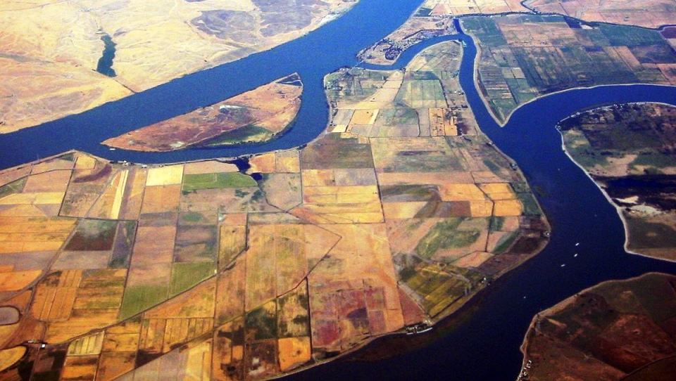
The Delta comprises a network of some 70 islands protected by over 1000 miles of levees. The soil on these islands is some of the richest farmland in the world because it is composed of organic material: decaying plants that accumulated over millennia.
But when civil engineers built levees 150 years ago to create farms, the soils dried out. This caused the organic matter to oxidize and decompose, so the surface of many islands has slowly sunk below sea level. This results in a stronger leverage force on the levees, making them more vulnerable to failure.
In other words, the levees are causing the very flooding that were intended to prevent. Unintended consequences seem to go hand-in-hand with civil engineering, due to the simplistic, single-focus approach most such projects employ.
In the Bay-Delta Area, over 90 percent of historic tidal wetlands disappeared in the last 150 years. Over 2.5 billion cubic meters of organic soils have disappeared since delta islands were first diked and drained for agriculture in the late 1800s, resulting in land subsidence up to 25 feet below sea level. Drained and cultivated organic soils continue to oxidize, subside and emit an estimated 1.5 to 2 million metric tons of CO2-equivalent annually — equal to annual emissions from over 300,000 passenger vehicles.
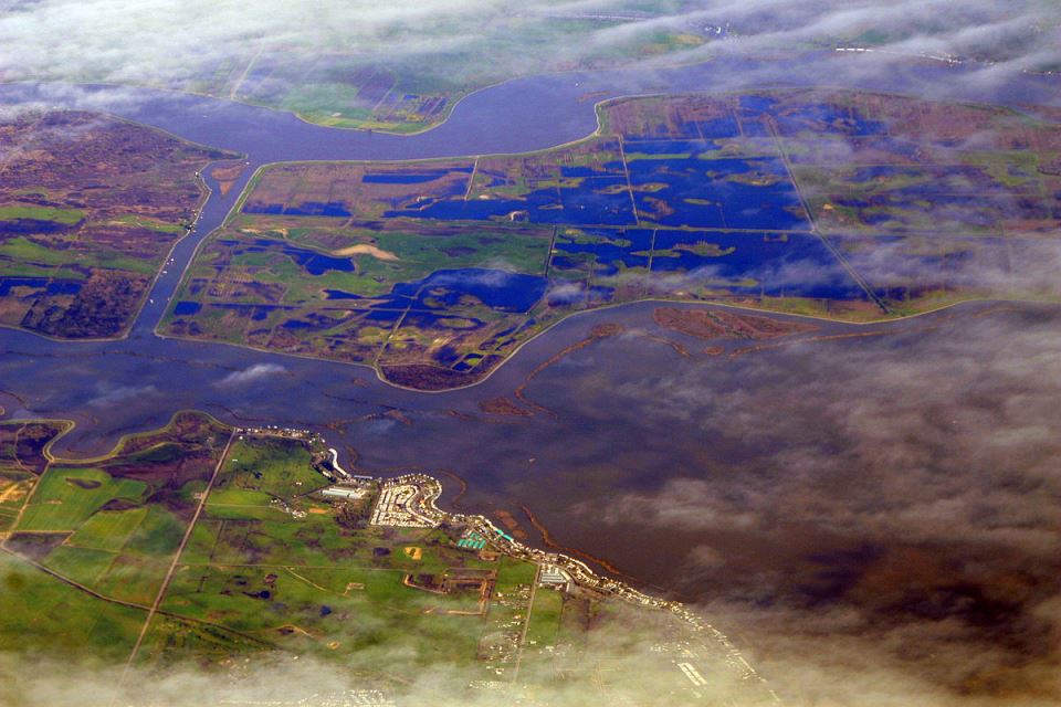
Delta at flood stage in spring of 2009.
Photo by Doc Searls via Wikipedia.
That’s a problem because the Delta is also the source of freshwater for 25 million Californians and more than 3 million acres of farmland. If numerous islands flooded due to levee failures, seawater could rush into the estuary and compromise the freshwater supply.
One solution to this conundrum is to simply allow the islands to flood again gradually, transforming them back into wetlands. Over time, wetland plants like cattails and tules would grow and die and slowly rebuild the soil elevation. But the process needs an economic incentive on a massive scale.
Now the Delta Conservancy has that incentive. The Conservancy, a state agency that oversees environmental and economic opportunities in the Delta, recently won approval from the American Carbon Registry (ACR) for a new carbon banking methodology. This means wetland restoration in the Delta (and other coastal areas of the state) can now generate money by selling greenhouse gas credits to polluting industries.
On April 25, 2017, ACR (a nonprofit enterprise of Winrock International) announced approval of a new carbon offset methodology to scientifically quantify greenhouse gas (GHG) emissions reductions from the restoration of California delta and coastal wetlands.
The methodology was developed by a high-profile group of partners — the Sacramento-San Joaquin Delta Conservancy as lead agency and HydroFocus as lead author with technical support from the University of California at Berkeley and Tierra Resources. Funding for the methodology was provided by the Sacramento Municipal Utility District (SMUD), the California Coastal Conservancy, the Metropolitan Water District and California Department of Water Resources (DWR).
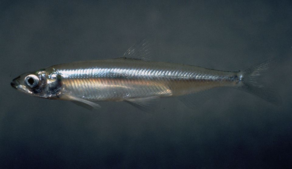
Endangered Delta smelt. Photo by Moose Peterson of the U.S. Fish & Wildlife Service
The new ACR methodology combines California data and restoration techniques to create a rigorous scientific framework for carbon offset project development. Opportunities are abundant to enhance current land-use practices by restoring wetlands or converting to rice cultivation in the Sacramento-San Joaquin Delta, Suisun Marsh, and California coastal areas.
Carbon offsets generated by the projects can be sold to corporations to meet their voluntary emissions-reduction goals. Additional sources of offsets are also being considered by California regulators for eligibility in the state’s Cap-and-Trade Program, under which power plants and oil refineries are mandated to reduce or offset their emissions.
“Restoration activities that rebuild subsided lands are critical to long-term ecosystem sustainability, are important to reducing the risk of levy failure and sea level rise, and are a significant source of GHG emissions reductions,” said Steve Deverel, President of HydroFocus.
Research in freshwater emergent wetlands on delta organic soils shows that carbon capture wetlands are the most carbon-rich landscape per acre. The U.S. Geological Survey (USGS), DWR, HydroFocus and the University of California at Berkeley have been studying subsidence and GHG emissions of rice and managed wetlands in the delta since the 1980s and have documented very high rates of primary productivity in wetlands.
“State and federal funding remains insufficient to address land subsidence that threatens the California water system, and carbon market revenues could help fill the funding gap,” said Campbell Ingram, executive officer of the Sacramento-San Joaquin Delta Conservancy. ”The new ACR methodology provides an incentive to landowners in the Sacramento-San Joaquin Delta, Suisun Marsh, and other historically natural wetland areas in California to convert their most subsided and marginal agricultural lands to wetlands or to produce wetlands crops such as rice, which will stop land subsidence and reverse it over time.”
Featured photo by worldislandinfo.com via Wikipedia.