
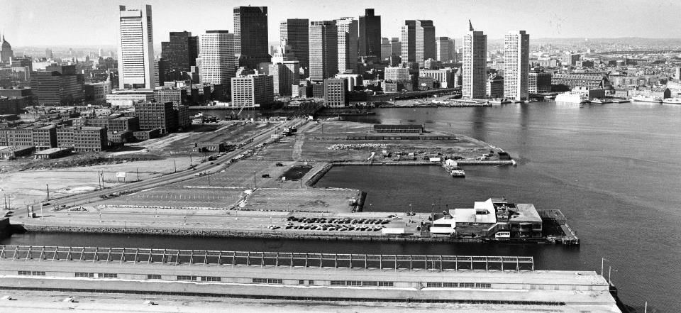
What was recently a desolate waterfront parking lot (see 1982 photo above) in Boston, Massachusetts is coming back to life in dramatic fashion.
Seemingly overnight, a new neighborhood is going up along Seaport Boulevard. Piece by piece, floor by floor, one building after another is being cobbled together.
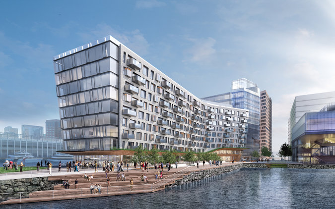
Image credit: Tishman Speyer
That means a lot of steel, glass, and jobs for many, many construction workers.
And when it’s done, there will be thousands more people living and working in a place that, not so long ago by Boston time, was little more than a giant parking lot by the sea.
Much of the area now known as the South Boston Waterfront, or Seaport, was originally tidal marsh. Landfill activity was initiated in 1833, and the area became home to new land, piers, and channels. Eleven wharves—four belonging to the Commmonwealth of Massachusetts—were added to South Boston’s port facilities. By the late 1880s, the Seaport was an bustling industrial center. As the industrial era quieted in Boston, the Seaport began to serve mostly as parking.
However, the turn of the 20th century into the 21st saw a burst of redevelopment in the area, with residential, office, and tourism uses being constructed along the waterfront.
The 1999 Seaport Public Realm Plan outlines the City’s goals for activating and enhancing the South Boston Waterfront. The five goals of the plan include:
- promoting Boston Harbor as a shared natural resource;
- preserving and enhancing the industrial port;
- planning the Seaport as a vital, mixed-use neighborhood;
- developing the Seaport as an integral part of Boston’s economy;
- and enhancing the South Boston Community.The 2000 South Boston Waterfront Municipal Harbor Plan’s primary goal is to ensure that the public has meaningful access to Boston Harbor along the Seaport’s coastline. The plan outlines strategies to create a harbor plan and public realm more in keeping with Boston’s urban character and mixed use economy. The 2009 amendment amendment updates the 2000 plan and includes information about the 100 Acre Master Plan.
The continuation of public realm planning in the South Boston Waterfront includes the recently completed 100 Acres Master Planning process for the Fort Point District. The goal was to create a public realm plan that would guide future development. The area’s population, historic buildings, cultural activity, industries, and commercial activities lend the district a unique energy that is treasured by residents, workers, and visitors alike. The district, however, is faced with major infrastructure changes, development pressures, and other community challenges and opportunities.
The 100 Acres Master Plan provides a framework for transforming the existing surface parking lots around the Proctor & Gamble/Gillette (“P&G/Gillette”) plant, the USPS facility, and Fort Point historic structures to a vibrant 24-hour, mixed-use neighborhood anchored by over 11 acres of new public open space and almost 5.9 million square feet of development.
The Master Plan is the culmination of over five years of collaboration between residents, property owners, City and State agencies, and other interested parties. Together these groups have created a bold vision for the 100 Acres that incorporates a broad set of planning principles and addresses many concerns voiced during the community process.
Key elements of the Plan include:
- Defining a land use plan for the district;
- Recommending appropriate building heights and density;
- Preserving industrial uses while encouraging an increased mix of uses, and providing buffers around industrial uses to prevent conflicts with nearby commercial and residential uses;
- Ensuring that at least one-third of development is housing, including an expansion of artist housing, and aggregating residential elements around open spaces;
- Extending Harborwalk along the entire length of Fort Point Channel;
- Providing an open space connection from the South Boston Bypass Road/Haul Road to the Fort Point Channel;
- Identifying the P&G/Gillette Plant as a critical water-dependent use on the Fort Point Channel; and;
- Establishing limits on the future build-out of the 100 Acres area, and implementing phasing of this development based on available and projected transit infrastructure capacity.
See full photo essay by Tim Logan and David L. Ryan in the Boston Globe.