
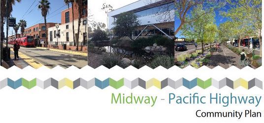
A strategically-located community of San Diego, California is about to receive a major redesign and (hopefully) revitalization.
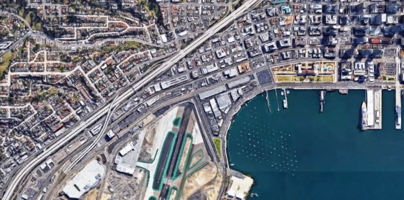
The Midway-Pacific Highway community of has an estimated population of 5633, and encompasses approximately 1324 acres within the central area of San Diego. It’s adjacent to the San Diego River, Interstate 5, San Diego International Airport, and the Peninsula community. The community planning area comprises three main elements: the Midway area, the Pacific Highway corridor, and the Marine Corps Recruit Depot San Diego.
The community has been the focus of several revitalization efforts in the past, but has little to show for them. Now, a new Community Plan Update seeks to improve Midway-Pacific Highway’s sense of place and foster livability by transforming it into a vibrant urban, pedestrian-friendly community with
unique districts and villages.
 The proposed community plan will provide a land use framework allowing for more housing opportunities within Transit Priority Areas (TPAs) and encouraging commercial activity and job opportunities for residents of the community and neighboring communities. It also aims to improve mobility for pedestrian, bicyclists and motorists; improve connections to transit by identifying mobility infrastructure improvements for implementation; and provide policies that attempt to influence travel mode choice toward active transportation modes and transit use.
In order to meet the City Council’s direction regarding the Bay-to-Bay connection, the community plan update proposes to implement a Bay-to-Bay multi-use path that will support bicycle and pedestrian travel between Mission Bay and San Diego Bay. It also proposes two linear parks connected by enhanced streetscapes that complement the multi-use path.
Additional parks, park equivalencies, and recreational facilities are identified in the updated community plan to serve future residents, along with public facilities and services. It also aims to capitalize on the community’s unique location by creating an outdoor-focused character that encourages pedestrian activity and gathering places that highlight Midway-Pacific Highway’s natural setting.
In concert with land use designations and policies that encourage and guide new development, the Community Plan’s Historic Preservation Element aims to
identify, preserve, commemorate, and educate the public about Midway-Pacific Highway’s historical and cultural resources.
Midway-Pacific Highway’s resources are its central location and its proximity to Downtown, the San Diego River, Mission Bay and San Diego Bay. It has ready access to the Old Town Transit Center and highways with local bus service; and trolley service at two stations in the community (Washington Street and Palm Street/Middletown).
Historically an area of tidal marshes and flats where the San Diego River branched at the mouth of Mission Valley, Midway-Pacific Highway’s topography is predominantly flat. The community has long been a crossroads for transportation routes connecting Old Town, New Town (Downtown), Point Loma, and Ocean Beach, and transportation improvements have shaped its development.
The community has been home to Kumeyaay paths between coastal and inland settlements; the trail between the Spanish landing point at La Playa and the Old
Town settlement; a portion of the Santa Fe Railroad’s transcontinental rail line; San Diego’s first streetcar line; U.S. Highway 101; aviation training and manufacturing; and Interstates 5 and 8. Midway-Pacific Highway’s long development history and diverse development influences have resulted in a broad mix of commercial, industrial, military, and residential land uses.
The General Plan City of Villages strategy calls for focusing growth into mixed-use activity centers that are pedestrian-friendly centers of community activity and linked to the regional transit system. The 1991 Midway/Pacific Highway Corridor Community Plan primarily focused new development along the planned Bay-to-Bay canal. It did not comprehensively integrate land use and mobility to create a pedestrian, bicycle and transit-oriented community.
In contrast, the proposed Midway-Pacific Highway Community Plan Update provides a strategy for addressing the automobile-oriented land use and circulation system and barriers to connectivity by placing emphasis on mixed-use village and districts connected by bicycle and pedestrian linkages.
Featured image via Google Maps.