

The city of Fier (population about 86,000) is surrounded by hills in southwestern Albania.
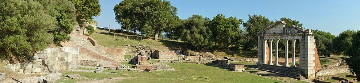
The ruins of Apollonia.
Photo by Pudelek via Wikipedia.
It’s just 11 km (7 mi) from the ruins of the ancient city of Apollonia.
Fier is about 16 km east of the Adriatic Sea coast, and 100 km south of the capital city of Tirana.
Now, the design firm MAU Architecture (based in Milan, Italy and Tirana) has proposed a revitalization plan for the city’s center, based on creating a linear park that reunites Fier with its water.
The project’s strategy is to revitalize those elements that characterize the heritage of Fier while renewing the quality of life. Central to this is restoring and reconnecting he downtown to the river that flows through the city’s heart.
Here’s how MAU Architecture describes the project:
(sorry: the translation is a bit rough)
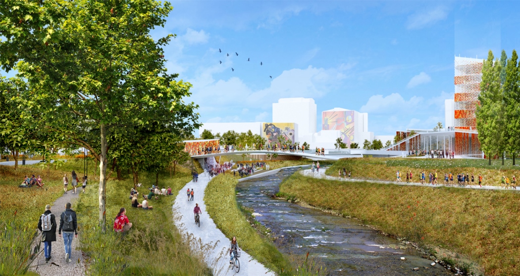 The city’s relationship with the river not only through the presence of a new urban platform, but through a connection to the broader and more complex territory.
River revelation towards transparency, visibility, visibility, usability and access to the coast; The greening relationship permits the recognition of a permeable boundary within compact constructions by enhancing visual perception.
Along the shore on the north side of the river, the project proposes, in this regard, a linear park that balances spaces through a green road network with a multidimensional vision due to different perceptions of views. The northern Axis also remembers a pedestrian system, the “Promenade”, and a wide greenery system.
 The relationship with the existing structures, the features of a physiognomy already rooted in the city’s landscape, will inevitably have the task of keeping together a complex system of interrelated relationships (historic roads and plants with new constructions) with poles of New urban development, but also with the great structures of the Communist era.
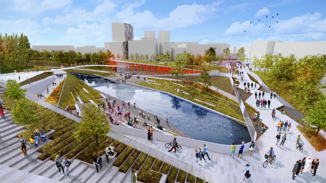
The project keeps the old axes of the city by putting them in service only for the pedestrian, while the “Europa Plaza” square becomes the generator of a third axis as the “new element” between the north and south of the city.
Two different flow rates in two quotes make it possible to use the project area at different speeds. On both sides of the river, a cycling system is developed, as a faster flow (projected throughout the city’s long river strategy). In a higher quota the main axes of the two existing bridges are preserved and a third axis (part of the project), of a façade of trees, as a tree area and a resting area, breaks the scheme.
The center of the whole system, the heart of the center, becomes the amphitheater along the river of river allowing the citizens to enjoy the new prospects that offer the two new premises of the barracks, which provides an occasion for creating a public space on interaction and approaching the river.
 On both sides of the river are placed new architectures with different functions.
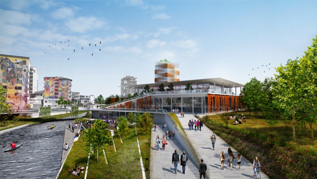
The new Axis (Assembled Bridge) assimilates the running of existing roads (Jakov Xoxa Str., Jakov Xoxa Str., Jakov Xoxa), Square Plaza Europa, becomes a new pole with the aim of activating interaction and increasing urban quality. From here it goes all the way, without obstacles, in one direction to multifunctional buildings.
The building, as an urban landmark, which in its cover adorns the directions of the three axes from which it is born, and allows the interaction to a higher level where people can enjoy the landscape that offers the whole project. From here we reach the urban park, immersed in a variety of essences and species of trees that create empathy by means of sensory experience.
All images courtesy of MAU Architecture.