
The winners of the Nutrient Sensor Challenge were announced at a special awards session at the Association for the Sciences of Limnology & Oceanography Aquatic Sciences (ASLO) meeting in Honolulu, Hawaii, on March 2, 2017.
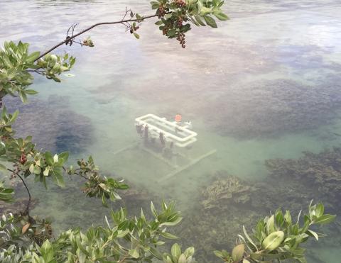
Launched in December 2014, the Nutrient Sensor Challenge aimed to accelerate the development, production, and use of affordable, reliable, and accurate nutrient sensors. These sensors will enable automated and high-resolution nutrient monitoring in aquatic environments ranging from freshwater lakes and streams to the coastal ocean.
Nutrient pollution is one of the nation’s most difficult environmental challenges. While nutrients are essential compounds for functioning ecosystems and the production of food, fiber, and livestock feed, excessive nutrient levels can dramatically alter aquatic environments and threaten economic and human health.
The need for nutrient sensors to better monitor the restoration of bodies of water (aquatic and marine) has long been recognized. Two papers (linked to below) illustrate this, one from 2006 and the other from 1993.
Abstract from 1993 NOAA paper:
The objective of this report is to provide a literature search-and a short review of wetland functional health determination techniques which are relevant to the NOAA CoastWatch Change Analysis Program and other related programs, e.g., the Environmental Monitoring and Assessment Program (EMAP-Wetlands) of the U.S. Environmental Protection Agency. The report also suggests areas where further research is needed. In chapter 2, we review those remote sensing techniques which appear effective for mapping abundance (biomass). We also outline the contributions of remote sensing to early vegetative stress detection, habitat quality, and hydrology.
In Chapter 3, we provide an overview of conceptual approaches for the assessment of wetland health, function and value. Then each of the proposed indicators of wetland condition is described in a chapter. Their importance is underlined, the techniques used for indicator sampling and measurement are briefly explained, and the remaining issues that must be resolved are outlined. Complete details of every technique are not discussed in this overview. references in each section for additional information. The reader is encouraged to consult the Our choice of the health indicators is essentially based on conclusions drawn from various interagency reports and planning meetings attended by us and the EMAP-Wetlands major assessment endpoints: productivity and biodiversity defined by the variety of species inhabiting the wetland, and sustainability defined as the wetland persistence over time.
The review includes all the remote sensing techniques that can be substituted for the conventional methods, or that are used in conjunction with them. Some indicators of wetland condition such as wetland extent and type, habitat structure, and the floral component of wetland productivity, can be studied primarily by means of remote sensing; while others (e.g., vegetation, hydrology, habitat quality) still require the use of more conventional techniques. Satellite and airborne sensors have been used for several decades in wetland mapping, but new remote sensing techniques have recently been developed, that allow researchers to determine wetland biomass production. These new techniques should enhance our ability to determine wetland condition and functional health over large areas and at
various repeat intervals.
From the Executive Summary of the 2006 paper:
The purpose of this study was to determine to what extent wetlands restored on private lands in Ozaukee County, Wisconsin are providing the landscape functions that were the expressed purpose of their construction: increasing plant diversity and water quality, providing wildlife habitat and storm water storage, and reducing soil erosion. We measured these functions on individual sites and then extrapolated their cumulative effects to a County landscape scale. The resulting information, will allow the agencies to improve the efficiency of use of future County wetland restoration funds to achieve effective restorations.
An assessment of the relative functions of the existing wetland restorations will enable adaptive decisions for improving the local County wetland restoration program. This assessment will contribute to establishing guidelines for maintaining existing and restoring future wetlands that will develop and provide a high degree of function, or ecosystem services.
During the past 20 years, federal, state, and local government agencies have constructed over 300 wetland restorations, covering more than 350 acres, on private land in Ozaukee County. Their efforts are continuing, with several additional wetlands appearing on the landscape each year through incentives such as those provided by the United States Department of Agriculture (USDA), United States Fish & Wildlife Service (USFWS), Wisconsin Department of Natural Resources (WDNR), and County Priority Watershed Programs. These programs encourage landowners to temporarily remove highly erodible land from agricultural use and restore natural plant communities. The projects were not intended to restore the pre-settlement (primarily forested) plant communities of the area.
The general goals of this restoration program are to: increase wildlife habitat and plant diversity, reduce soil erosion, improve water quality by filtering pollutants and sediments, and provide storm water storage to reduce flooding Ozaukee County initially completed a Geographic Information System (GIS) inventory of these wetlands. GIS digital coverage includes: 5-ft. DEM, and 2-ft. Topographic Mapping; IKONOS 2001 MS Satellite Imagery; Southeastern Wisconsin Regional Planning Commission 2005, 2000, & 1995 Orthophotography and 1995 and 2000 Land Use; SSURGO Certified Soil Survey; WDNR Wetland Inventory and Subwatershed Boundaries. As a result of this effort, many questions regarding this population of wetlands can now be easily answered, and the wetland sites have been added to the state wetland inventory.
While inventorying these wetlands is important, inventory alone does not constitute a comprehensive wetland restoration assessment and monitoring program. Much effort is needed beyond the initial inventory to examine how the wetlands currently function as components of the county landscape. It is also essential that we have a means to monitor changes in the functional status of these wetlands as well as the restoration of additional wetlands in the county. This project expanded on the GIS approach to inventorying wetlands, allowing us to evaluate the current ecologic functions and estimate the resulting impacts on the landscape utilizing a combination of landscape, rapid, and intensive site assessment levels.
For this project we collected field data on biological functions in 35 wetlands and combined that with historical and current data on 19 and 66 sites espectively, providing a large (40%) sample of the county wetland restoration population. Our sample allowed inter-comparison of sites ages 1-17 years as well as intra-comparison of several sites at 1-3 years and again at 12 years post construction. We assessed the physical functions of the sample sites using the modeling function of GIS software and digital data layers. The measurable differences between current and pre-restoration landscapes allowed us to assess change due to construction of the wetland sites. These data were statistically and spatially analyzed for differences in function related to restoration design and placement in the landscape.
In addition, a survey was developed and utilized to aid in the identification of the most common and immediate management concerns of the landowners. This information, along with the functional assessment results, was used to develop a county monitoring plan that can be utilized by all agencies participating in the restoration program.
See full University of Maryland article on 2017 sensor awards & photo credit.
Download full 1993 NOAA paper on need for remote sensing in wetland restoration.(PDF)
Download full 2006 paper on the monitoring of wetland restoration.(PDF)