
In India, the government of the state of Andhra Pradesh is speeding up efforts to return degraded land to productivity through local engagement, landholder education and skill enhancement.
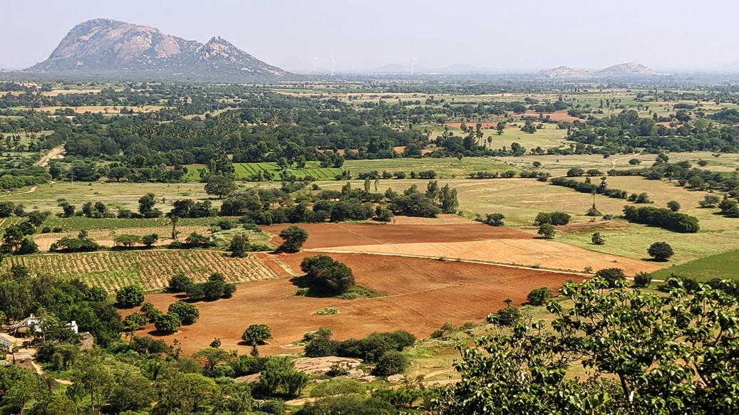
Landscape of Yerraborepalli Village, Anantapur District. Photo: World Agroforestry / Tor-Gunnar Vågen.
The Government of Andhra Pradesh has been taking active measures to counter the degradation of the state’s land and the threat of desertification, to enhance biodiversity, and to improve farmers’ livelihoods.
One of the ways this is being done is through the Andhra Pradesh “Zero-Budget” Natural Farming Programme, implemented by Rythu Sadhikara Samstha, a corporation for farmers’ empowerment.
Zero-budget natural farming focuses on regenerating soil fertility, reducing water use and increasing species’ diversity through natural agroecological approaches. Rythu Sadhikara Samstha aims to convert 8 million hectares in Andhra Pradesh, farmed by 6 million farmers, to zero-budget natural farming.

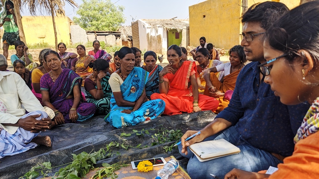
Workshop participants. Photo: Jailuddin, India.
To support the efforts of the Government through Rythu Sadhikara Samstha, World Agroforestry (ICRAF), along with the Accion Fraterna Ecology Centre and the Climate and Land Use Alliance, held a 5-day workshop, 2–6 November 2019 in Anantapur, attended by 77 people.
The workshop aimed to help participants understand the phenomenon of desertification and land degradation across the district of Anantapur and identify sustainable options to reverse them.
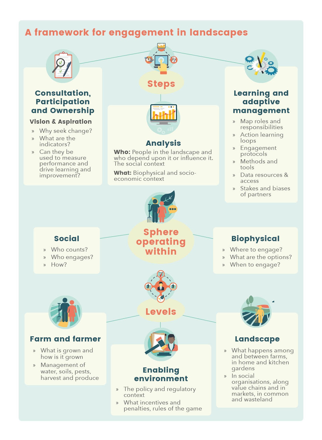
A key objective of the workshop was to develop an operational plan for developing an ‘engagement landscape’ by drawing an initial set of hypotheses, building on best practices and local successes and including modalities for implementation by the District administration with technical support from partners for monitoring and scaling out.
Engagement landscape
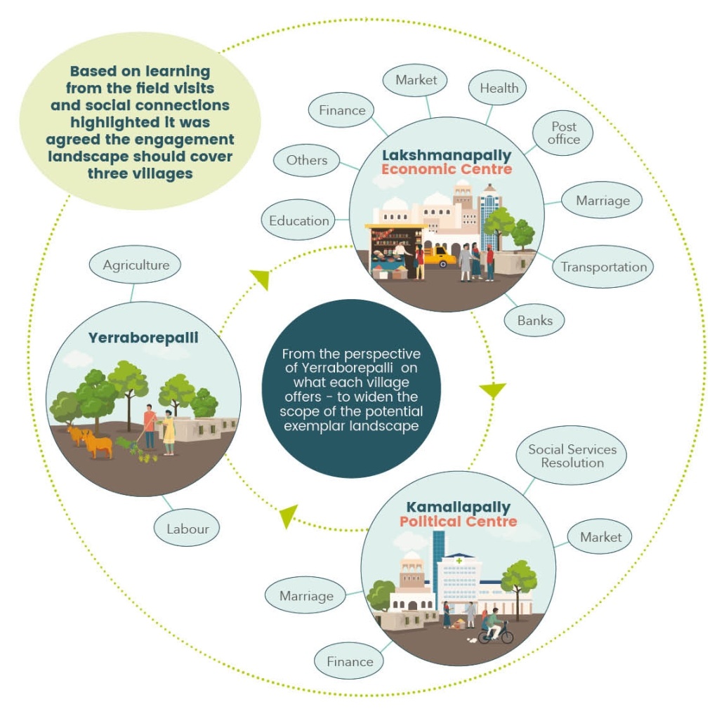
An “engagement landscape” aims to engage across multiple villages and understand their connections. Diagram shows relationship among three major villages in the landscape.
An “engagement landscape” is a discrete and recognizable geographic unit of sufficient scale (more than one village, certainly) to address challenges without artificial reduction of complexity. It will typically have multiple layers of governance, different types of stakeholders, farmers and value-chain actors.
Engagement landscapes place the focus on local communities, who are invited to contribute towards outlining desirable, sustainable outcomes that they aspire to achieve.
This process supports locally adapted and refined solutions rather than adopting a one-size-fits-all approach. This is especially necessary in areas with highly variable landscapes, such as in Anantapuramu.
During the development of the engagement landscape, approaches, protocols and ‘tools’ are also designed to deliver replicable results in a transparent and accountable manner.
 The workshop commenced with knowledge-sharing sessions, including the identification of the root causes of desertification, the changes that have taken place over time — both socially and ecologically — across the district and the current land management being implemented to reverse degradation processes.
Candidate landscapes were introduced and participants were encouraged to interact with existing data through ‘data walls’, with the aim of generating a shared understanding of key characteristics and issues.
This involved discussions about what participants already knew from the data, where the gaps were, and their expectations around what they thought would work under the various contexts.
Engaging with evidence

Malla Reddy of Accion Fraterna Ecology Centre explaining the spatial patterns of soil organic carbon maps from ICRAF’s GeoScience Lab. Photo: World Agroforestry/ Leigh Winowiecki.
“Data walls” are a unique tool developed by ICRAF’s Stakeholder Approach to Risk-informed and Evidence-based Decision-making (SHARED) team to engage participants with different forms of data and to encourage discussion around the current state of knowledge, in this case, of the degradation challenging the region.
Maps of key indicators of land and soil health were produced by ICRAF’s GeoScience Lab, including maps of erosion prevalence, tree cover, soil pH, and soil organic carbon.
Based on this understanding, and through extensive consultation with local communities prior to the workshop, a field trip allowed participants to engage with the communities within the landscape. During the trip, participants divided into thematic groups and conducted group discussions with the communities.
Themes included out-migration, livestock, gender issues and water constraints. This participatory interaction gave the participants the opportunity to find out more about local stakeholders’ aspirations, challenges and realities with regard to desertification and adapting to drought.
Afterwards, participants collaboratively identified options for landscape management that may be appropriate and transformative for livelihoods.
The participants were encouraged to reflect on what they wanted to achieve, different approaches that could be used, and the likelihood of the different proposed intervention activities having the desired impact.
Key outcome
A key outcome of the workshop was the development of an operational plan for developing an engagement landscape in Anantapuramu. In addition, through stakeholder consultations, the process has secured agreement, in principle, to scale up the use of such engagement landscapes across Andhra Pradesh in order to promote innovation and adoption of alternative, climate-resilient farming and landscape practices that are carbon positive. Stakeholders involved in the process are now eager to start implementation and learning in the engagement landscape.
The event was reported by several media outlets, including The Hindu as well as local media.
Featured photo (courtesy of World Agroforestry/Tor-Gunnar Vågen) shows focus-group discussions being conducted in Yerraborepalli Village to better understand the constraints and challenges facing farmers.
This article by Sabrina Chesterman, Mieke Bourne and Leigh Ann Winowiecki originally appeared on the website of the World Agroforestry Centre.
Reprinted here (with minor edits) by permission.