
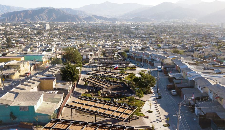
The city of Copiapó in northern Chile basosts a great regeneration story in the form of Parque Esmeralda. It has been built on the site of a formerly-beautiful stream that had dried up, and that had been used as an informal landfill for over four decades.
This new park is helping to revitalize a public housing development on the outskirts of the city, at the border with the Atacama Desert.
Here’s what the architects at CAW Arquitectos say about their project:
 In its origins, the land where the project was built was part of a small stream, but for more than 40 years it was filled with garbage and rubble.
In this context, residents of the Esmeralda population—made up of more than 300 vulnerable families—had a historical desire to transform and recover this landfill into a meeting space that would become the heart of the neighborhood.
This was the center of the Esmeralda Project: to give its neighbors a green and habitable space that since its construction in the 80s did not have any facilities or public recreation areas.
Implementing green in the desert and on slopes, on a periphery of extreme poverty.
 The origin of the project consisted in delving into the idea of an “urban garden”, a green place in the desert, which could mitigate and coexist in the extremely arid environment of the Atacama Region, known for being the driest desert in the world.
But achieving a public space with high water scarcity and located in a vulnerable sector was a tremendous challenge. We interrogated ourselves: How can we generate the greatest amount of green perception with the least amount of green area?
Thus, the spearhead of the design consisted in working on a strategy of green visual perspectives, which implied observing not only the park’s land but also the surrounding passages where the neighbors pass daily.
 We also realized that numerous passages end in the parking area, which triggered a proposal to strategically locate groves at the visual intersection of the streets with the park.
In this way, each neighbor would obtain a vegetated area as a visual finish for their passage, instead of the existing unhealthy pile of garbage.
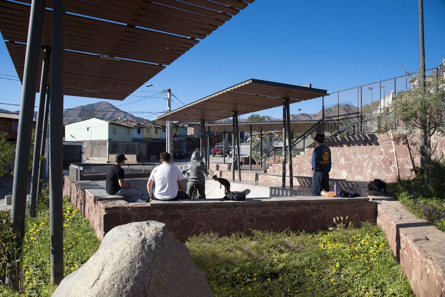
Inside these groves, the project contemplates accessible circulations, small meeting places, and community gardens, which finally unite two neighborhoods that were divided for decades since they were separated by the landfill.
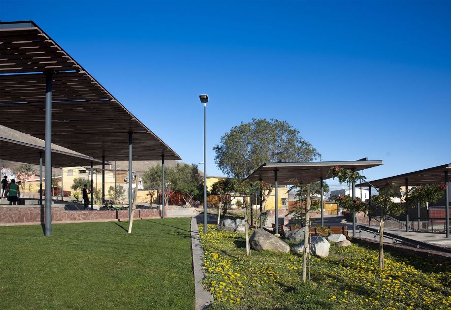
 In this way, the park is composed of a delicate social and ecological fabric between zones of high vegetation cover, intermediate zones of lower vegetation, orchards, and more exposed programmatic zones (with pavements).
With this strategy, large heat islands are avoided, always trying to be “surrounded by the green”.
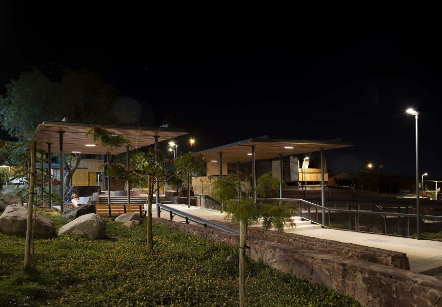
In the longitudinal direction and given the steep slope (42m of unevenness), the park is projected based on terraces with rocks from local stonemasons, which give rise to multiple viewpoints of the Copiapo Valley.
This is a process of a series of workshops with the neighbors during the design stage, and then the construction of green areas and stone walls.
All photographs are by Rodrigo Werner.