
In recent years, the financial and social costs of natural catastrophes in Canada have escalated beyond historical levels. Residential flooding has been a key driver behind this trend, which has led to upward pressure on residential insurance premiums, mental health stress for homeowners impacted by flooding, potential increases in residential mortgage defaults, and lawsuits directed to builders and municipalities that fail in their fiduciary duty to anticipate and mitigate flood risk.
Fortunately, a range of practical solutions can be deployed to reduce and limit risk of flooding across a variety of circumstances. These include proactive maintenance of flood control structures, re-grading of lots and roadways, constructing new or upgrading stormwater storage facilities, and many other measures.
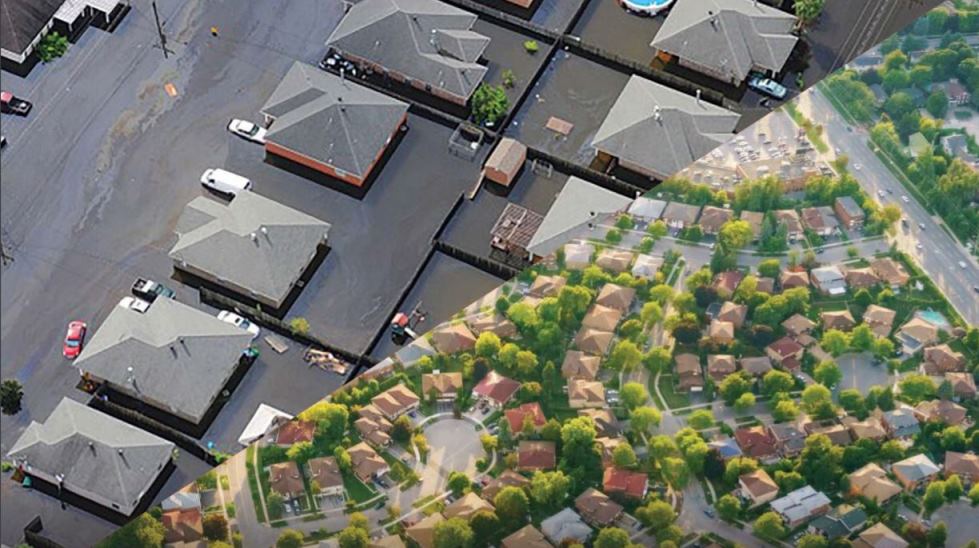
In January of 2019, the Intact Centre on Climate Adaptation at the University of Waterloo (Ontario) published a new report titled “Weathering the Storm: Developing a Canadian Standard for Flood-Resilient Existing Communities.” While Canada-focused, most of its its insights and recommendations apply to communities anywhere in the world.
Public engagement and education programs on flood prevention and maintenance activities can also drive the uptake of flood-resilience initiatives in existing communities, particularly for “lower cost” solutions that depend on homeowner participation and support.
To effectively prioritize these different approaches to mitigating flood risk, a flood hazard and vulnerability screening framework can help identify areas in existing residential communities that require the most immediate attention. Drawing on extensive engagement with key stakeholders across Canada, this report outlines such a framework, consisting of the following key considerations:
- Age of development: in the absence of major retrofits, older areas in Canada (e.g., pre-1970’s) are typically more flood-prone, compared to
newly-built subdivisions; - History of flooding: in absence of major retrofits, where municipal records (e.g., flood reports) indicate that repeated floods have occurred, these areas may be the most flood-prone;
- Design standards: areas where community design standards were less stringent (e.g., permitting development in the floodplain) are typically at a higher risk of flooding;
- Proximity to the floodplain: areas located closer to the floodplain are typically at a higher risk of flooding;
- Topography: lower-lying areas are typically at a higher risk of flooding;
- Land use changes and intensification rates: areas where significant urbanization and growth has occurred, and where natural capacity to absorb
rain water has diminished (e.g., as a result of losing permeable areas to development), are at a higher risk of flooding; - Sewer system types: areas with combined sewer systems (CSS) (e.g., systems that carry sanitary and storm water in one pipe), or partially-separated sewers, compared to fully separated systems, are typically more flood prone; and
- Presence of critical infrastructure, essential services and social vulnerabilities: each of these criteria would prompt more urgent response to the identified flood-hazard areas.
Application of the framework will enable communities to make better-informed decisions when prioritizing areas for flood-resiliency programming.
The purpose of the report is to serve as a seed document for a future National Standard of Canada, to be developed based on this framework. Guidance in this report has been well-vetted, as it draws heavily on the insights of municipal planners, engineers, consultants, conservation authorities, developers,homebuilders, insurance industry representatives and stakeholders across Canada.
Featured image is from the report.