
In New Jersey, contaminated site redevelopers and communities wishing to revitalize got a Valentines Day present from the governor.
That was when Gov. Phil Murphy‘s administration made it easier to identify once contaminated and blighted properties that present unique opportunities for economic revitalization and environmental remediation.
Many cities have numerous brownfield sites within their borders, but don’t have capacity or awareness on how to identify and market them.
Nor do they have a proven strategic process for turning individual brownfield projects into overall community revitalization. As a result, they tend to see brownfields as impediments to revitalization, rather than as the ingredients of revitalization (as described in the 2020 book, RECONOMICS: The Path To Resilient Prosperity.
In collaboration with the Department of Community Affairs and the New Jersey Economic Development Authority, the Department of Environmental Protection enhanced its Geographic Information System (GIS) mapping application, creating a brownfields inventory mapping layer that makes valuable information about brownfields sites easily accessible, helping investors, developers, community leaders, Licensed Site Remediation Professionals (LSRPs), and the public to identify brownfields with redevelopment potential.
“Revitalizing these sites is not only good for the economy, but it is helping clean up decades of misuse and abuse in our most disadvantaged neighborhoods,” said Lt. Governor Sheila Oliver, who also serves as Commissioner of the Department of Community Affairs.
“Brownfields place a tremendous economic, environmental, and public health burden on communities. This mapping enhancement will help people identify where brownfields are located and what government programs exist to help remediate the contaminated sites in the hopes of encouraging investment to bring these properties back to their full potential usage,” she added.
As defined by state law, brownfield sites are abandoned, idled, or underused industrial and commercial facilities where expansion or redevelopment is complicated by real or perceived environmental contamination.
Developers are interested in finding brownfield opportunities but previously had no mechanism to find them unless they were being advertised by a commercial realtor. This GIS enhancement will fill this void.
Cleaning and redeveloping brownfields can help to revitalize neighborhoods, improve public safety, create jobs, enhance the tax base, establish open space, and catalyze regional growth.
“Every brownfield remediation project is restoring injured natural resources and helping to preserve resources within greenfields and woodlands that are providing valuable services to the public and might otherwise be developed. Every brownfield site that is cleaned up and redeveloped represents an investment in both the economic and environmental health of our communities,” said Commissioner of Environmental Protection Shawn M. LaTourette.
“Viewing environmental improvements as sound investments has positioned DEP to drive economic growth in communities across New Jersey, and this new tool will better enable those in both the private and public sectors to join us in enhancing our residents’ quality of life, especially in our urban and underserved communities,” he continued.
Based on information accessible through DEP records and available through the DEP Brownfields Program and the DCA New Jersey Community Asset Map, the Brownfields Inventory GIS layer provides details on potential target sites, including acreage, cleanup status, and property owner contact information.
At present, the tool includes sites located in municipalities participating in DEP’s Community Collaborative Initiative (CCI): Camden, Trenton, Perth Amboy, Bayonne, Bridgeton, Jersey City, Millville, Newark, Paterson, Paulsboro, Salem, and Vineland. DEP intends to include opportunities in additional municipalities in future versions of the tool.
“Governor Phil Murphy recognizes the value of remediation and redevelopment of brownfield sites as an essential element of smart planning that will advance a stronger fairer New Jersey economy,” said NJEDA CEO Tim Sullivan.
“The comprehensive suite of technological and financial tools the NJEDA and its partners at the Department of Community Affairs and Department of Environmental Protection will amplify the economic and environmental impact of the State’s investment, revitalizing dormant sites and driving job creation through productive reuse of long inactive properties,” he explained.
Licensed Site Remediation Professionals, who are responsible for the investigation and remediation of thousands of sites across the state, will be able to supply important information on brownfield sites to their clients, whether a municipality or redeveloper, raising the level of awareness of redevelopment opportunities. The LSRP will also be able to access the CCI representative in the city of interest.
The CCI program supports environmental and community revitalization, equitable economic development, and enhanced public health outcomes in designate communities. A DEP liaison works closely with these underserved cities to build relationships and better understand the specific needs of their assigned city.
The NJEDA recently announced that it is accepting applications for the new Brownfields Impact Fund, which provides grant funding and low-interest loans to public sector and non-profit organizations, as well as low-interest loans to for-profit organizations, to carry out cleanup activities at brownfield sites throughout the state.
While applicants from any city can now apply, only applicants with projects located in the 12 CCI communities will be considered for the first 90 days the application is available. After April 20, applications from non-CCI communities will also be considered. The application and more information are available at https://www.njeda.com/brownfieldsimpactfund/
The program is first-come, first-served, with consideration given to the CCI communities for the first 90 days the application is available.
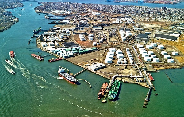
Photo courtesy of the City of Bayonne, New Jersey.