
In the aftermath of the damage wrought by hurricanes Harvey, Irma, and Maria, many residents in areas surrounding Houston, Texas, in the state of Florida, and throughout the Caribbean region are struggling to satisfy their immediate and most basic needs.
But as the devastated communities start thinking about long-term recovery efforts, they will need to carefully consider their rebuilding strategies. Rising sea levels and warming ocean temperatures will only increase the intensity of future storms and the threat to coastal cities and towns.
 Places to look for examplars are New York and Connecticut, where projects aimed at improving resilience are nearing construction, five years after Hurricane Sandy slammed into the region.
Two infrastructure projects in particular, one for Lower Manhattan and another for Bridgeport, Connecticut, could provide lessons in preparing for the next superstorm.
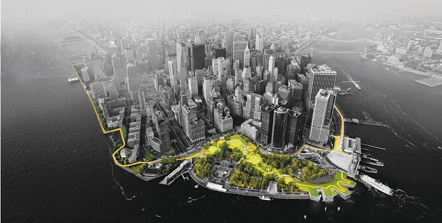
In Manhattan, a team led by the Danish firm Bjarke Ingels Group (BIG) produced the scheme known as “The Big U,” a buffer that relies on an assortment of strategies and both “hard” traditional infrastructure, such as walls and gates, and “soft” elements like green space and berms, which would double as community social and recreational areas.
It will wind around the shoreline in the shape of a “U” and protect the southern tip of Manhattan from storm surges and flooding.
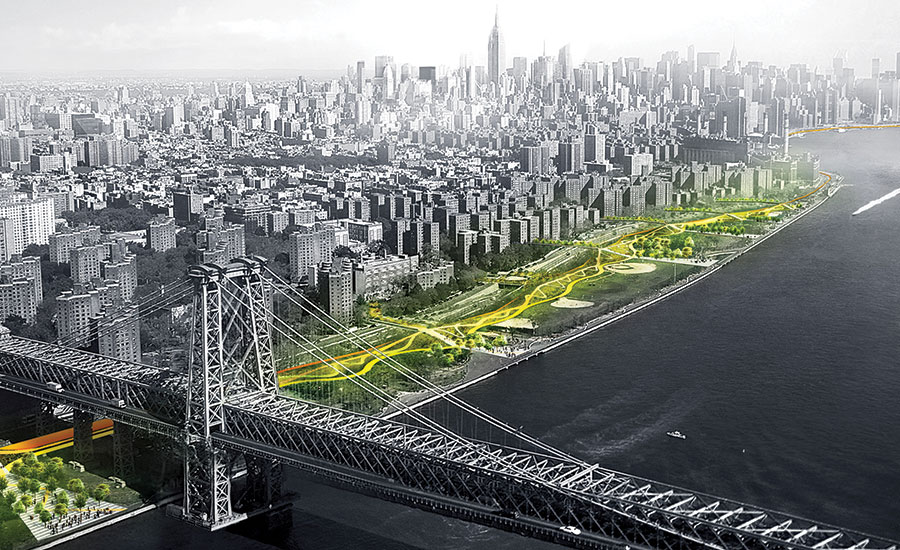
 The BIG U has been divided into two implementation phases: the East Side Coastal Resiliency (ESCR) project, which stretches for 2.2 miles along the East River, from 25th Street to just south of the Williamsburg Bridge, and the Lower Manhattan Coastal Resiliency (LMCR) project, which extends below the Manhattan and Brooklyn Bridges to the Battery.
With construction slated to start in 2019 and be completed by 2025, the design for the ESCR, for which almost $800 million in federal and city funds have been committed, is the most developed of the two phases.
It will improve pedestrian connections across the multi-lane FDR Drive to the East River and Stuyvesant Cove Parks with broad and sinuous footbridges.
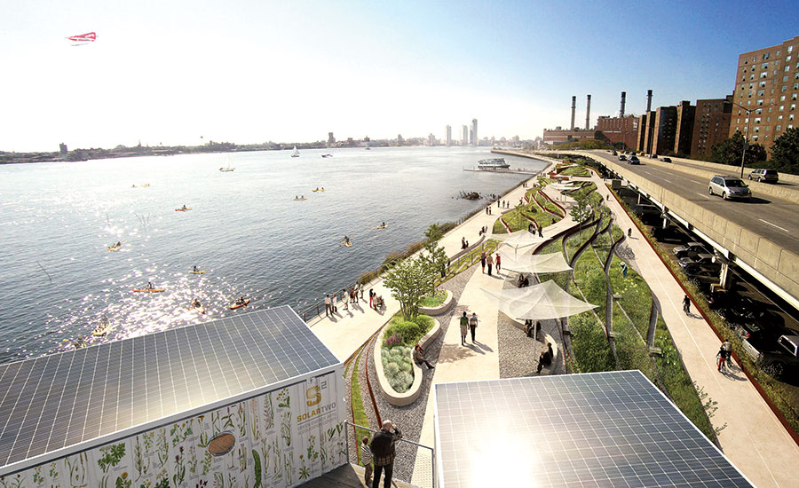 Thus, this design is a great example of the increasingly-popular 3Re Strategy (repurpose, renew, reconnect): it’s repurposing and renewing coastal properties for flood resilience and recreation, while reconnecting the waterfront to the neighborhoods.
Sixty miles up the coast from Manhattan, a similar combination of hard and soft infrastructure strategies is planned for Bridgeport, Connecticut, which straddles the Pequannock River and lies exposed to the Long Island Sound on a set of peninsulas. The once-thriving industrial city was hard hit by Hurricane Irene in 2011, and then by Sandy a year later.
“The tendency is to look only at the infrastructure, but the first thing to consider are the natural systems,” says David Waggonner, president of New Orleans–based Waggonner & Ball, which is leading the Rebuild by Design team known as Resilient Bridgeport.
All renderings courtesy of Bjarke Ingels Group (BIG).
See full Continuing Education article in Arch Daily by Michael Cockram.