
In March of 2017, Philadelphia, Pennsylvania Mayor Jim Kenny announced a crucial project that’s been a long time coming. He said that Philadelphia would finally see I-95 capped with a pocket park of green, connecting its bustling center with the banks of the Delaware.
Mayor Kenney, in his second-year budget, proposed spending $90 million to cover Interstate 95 between Walnut and Chestnut Streets with an elevated 11-acre swath that would also cross Front Street and Columbus Boulevard, ending at the Delaware River waterfront.
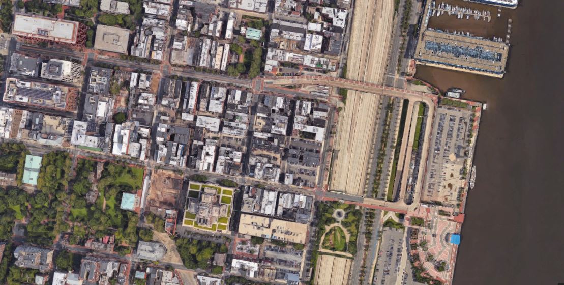
Aerial view via Google Maps.
The total cost for the project was expected to be $225 million, with $100 million coming from the state, and the William Penn Foundation contributing several million dollars.
“We’re getting a large opening space, we’re covering a highway that while functional is an eyesore,” Kenney said. “We’re going to be able to access the river directly, and I think that’s going to be great for the businesses in Old City and Society Hill and the historic area, and it’s going to allow families in North and South and West Philadelphia to lay on the lawn and see the river and enjoy the sites.”
Now, on July 25, 2017, the first major work of the long-awaited project to reconnect Center City Philadelphia to the Delaware River began when Philadelphia’s waterfront manager started taking down the concrete highway ramps between Market and Chestnut Streets.
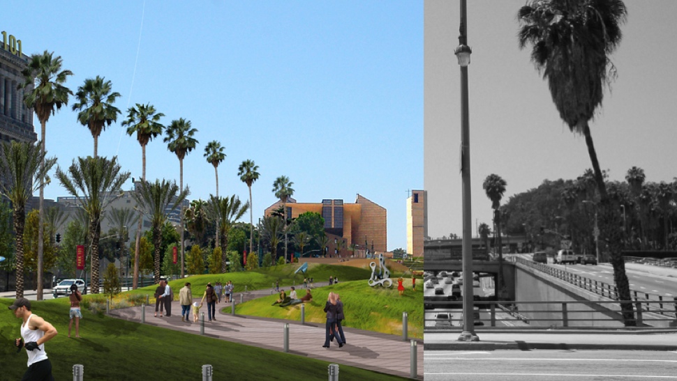
Philly’s earlier successful “highway cap park” over I-95 inspired the current effort.
Photo credit: Storm Cunningham
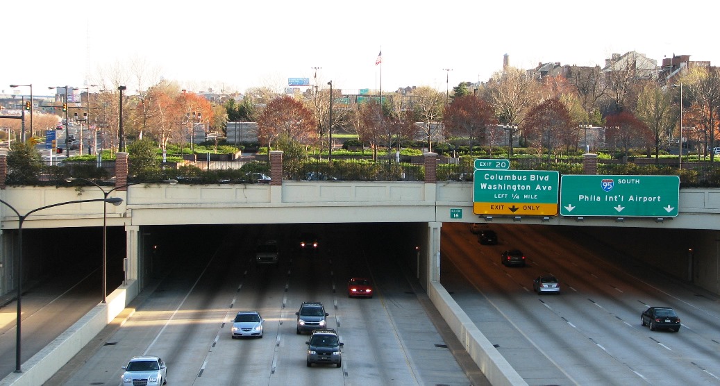
Built in the 1970s, when Philadelphia envisioned a clutch of high-rise towers springing up on Penn’s Landing, the crisscrossing “scissor” ramps are now considered a redundant piece of highway infrastructure that impedes views of the river.
Their demolition is intended to prepare the waterfront for the construction of a cap over I-95, said Joseph A. Forkin, president of the Delaware River Waterfront Corporation. He expects the work to take about four months.
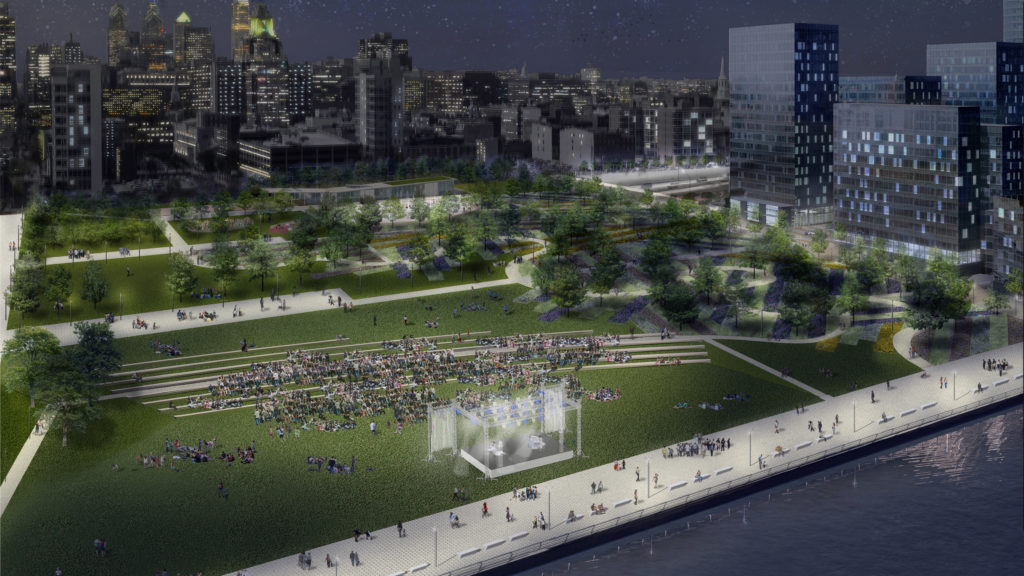
Nightime rendering courtesy of Delaware River Waterfront Corp.
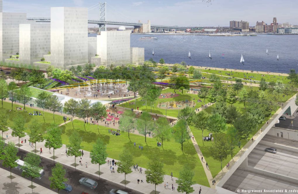
In June of 2017 the agency announced it had secured virtually all of the $225 million needed to build the 11-acre cap, which will span both the highway and Columbus Boulevard, between Chestnut and Walnut Streets.
The cap will be covered with a landscaped park. It is intended to provide a seamless, walkable link from Front Street in Old City down to the river’s edge, as well as a new amphitheater to replace the Great Plaza.
“We are pleased to join the city, state and Delaware River Waterfront Corporation in their efforts to realize this vision of creating a new, regional recreation destination,” said William Penn Foundation Executive Director Shawn McCaney.
One of the best is in Dallas, Texas, where five downtown acres over the Woodall Rodgers Freeway were reclaimed in 2012 to create Klyde Warren Park.
Boston’s infamously-corrupt, badly-executed, but well-designed “Big Dig” project relocated several disruptive freeways underground, resulting in the Rose F. Kennedy Greenway.
 Freeway cap parks have been around almost as long as freeways, as cities tried to remedy the atrociously-planned urban highways that afflicted, separated, and devitalized their neighborhoods.
Technically, the Brooklyn Heights Promenade, where the BQE tucks under a pedestrian walkway, is a freeway cap dating to the 1950s. Seattle, Washington‘s too-aptly-named Freeway Park (above) was constructed in 1976 as a Brutalist wonderland where the sound of waterfalls (almost) drown out the 5 Freeway below. In Phoenix, Arizona, the 10 Freeway was routed into a tunnel when it was built in 1990 and Margaret T. Hance Park was built on top.
But freeway caps have come a long way in the last 20 years. Capping, or adding “decking” to the freeway, can be more time- and cost-effective than other redevelopment plans (Dallas built theirs in only two years) and may be eligible for federal transportation money.
And because they’re located in already densely populated areas, many of these parks aren’t just covering eight-lane eyesores, they’re offering amenities like farmers markets, cultural programming, transit connections and bike facilities right where neighborhoods need them most.
Not to mention the feel-good social impact of reuniting communities that were torn apart 50 years ago.
Featured rendering courtesy of Hargreaves Associates.
See July 25, 2017 Philadelphia Enquirer article by Inga Safron.
See March 3, 2017 Philadelphia Enquirer article by Claudia Vargas & Julia Terruso.