
On May 6, 2019, the Waterfront Alliance released its latest plan for repurposing, renewing and reconnecting (AKA: the 3Re Strategy) Governors Island—a former military property in New York Harbor—in order to further revitalize it.
The essence of the plan focuses on activating the island’s periphery via ferry and freight service, historic ship berths, kayak and small boat docks, recreational facilities, and educational activities.
As The Trust for Governors Island (The Trust) moves forward with the transformation of Governors Island into a dynamic, year-round destination, activation of its waterfront is an important undertaking, says the Waterfront Alliance.
“We’ve all come to love Governors Island for its peaceful green space and cultural programming. Now that The Trust, in collaboration with the Waterfront Alliance, is embarking on a plan to activate the perimeter of the island, Governors Island’s transformation takes on a whole new dimension. Thanks to both entities for recognizing the importance of an active and accessible waterfront,” said Manhattan Borough President Gale Brewer.
A service provided by the Waterfront Alliance, a Maritime Activation Plan (MAP) reflects the mission of the Alliance—to inspire and effect resilient, revitalized, and accessible coastlines for all communities—and is customized to suit organizations and waterfronts of all locations and sizes.
This is the second MAP produced by the Waterfront Alliance, after its first plan was created in 2017, in partnership with Brooklyn Bridge Park. The Alliance is exploring opportunities to bring MAPs to waterfronts across the metropolitan region.
“Governors Island’s position at the center of New York Harbor requires thoughtful and comprehensive planning of its waterfront,” said Michael Samuelian, president and CEO of The Trust for Governors Island. “We thank the Waterfront Alliance for creating an actionable plan to not only activate our maritime infrastructure to expand access to the Island, but to utilize the Island as a living laboratory for connecting our visitors with the diverse activity and ecology that lives along our waterfront.”
With this Maritime Activation Plan, the Waterfront Alliance examines how The Trust can make the most of its 2.2-mile perimeter and offers practical and creative recommendations for addressing the challenges of an island in New York Harbor and capitalizing on that island’s unique waterfront assets. The Governors Island MAP was constructed with input from dozens of the most experienced maritime experts from our region and around the country, along with local stakeholders.
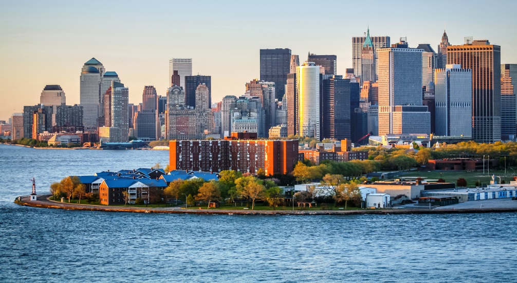
A historic, 172-acre jewel in New York Harbor, Governors Island today is a popular destination for recreation, arts and culture and learning with extraordinary open space. Valued for its strategic location, the Island through the years was home to critical military outposts, from colonial militias to the United States Army and Coast Guard.
“Governors Island is a case study of the city’s underutilized waterfront, but also its potential to create balanced waterfront spaces where use of the waterfront drives the economy,” said Michael Marrella, director of the New York City Department of City Planning’s Waterfront and Open Space division.
When the Coast Guard departed in 1996, the federal government transferred the Island to the State and City of New York. In April 2010, the City assumed control of the development of 150 acres of the Island and, via a design competition, settled on a master park and public space and development plan by the international firm West 8.
For the past 15+ years, the public has been able to enjoy Governors Island, exploring its verdant open spaces, carfree avenues, winding park pathways, and arts, cultural, and educational programming. Until now, however, the waterfront potential of Governors Island has not been fully realized. While the Island’s storied past is rich, its future has even greater potential, as a model of revitalized, resilient, accessible, and innovative waterfront uses.
Highlights of the Governors Island MAP:
- Expand ferry service to meet demand; inaugurate routes from diverse neighborhoods: Weekend ferries to Governors Island now carry more than 10,000 people per day. The MAP suggests using that number per day, for seven days, as a basis for planning future ferry service. The MAP also recommends investing in dock infrastructure and increasing access and equity with direct ferry service from diverse neighborhoods.
- Offer greater recreational and educational opportunities; invite more boating; offer access to the small, natural beach: Except for the occasional special program, current recreational and educational activities are focused inland. This MAP calls for more opportunities for people to touch the water, more recreational boating and a new marina, and an educational and recreational district at Piers 101 and 102 that would host tall ships and historic vessels, public kayaking and Harbor School/Billion Oyster Project activities.
- Invest in new infrastructure for freight access: Currently, nearly all freight and trash is moved from the Island by trucks on the Lower Manhattan crossing,
which share ferries with the public. This MAP recommends that The Trust invest in new freight infrastructure and work with a maritime freight operator to establish a service entrance at Lima Pier. - Maximize management: Because dock and boat maintenance, infrastructure and crew certification, cargo freight handling, and marine regulatory management require expertise, the MAP advocates for a continuation and expansion of contracts with marine services companies, as well as the hiring of one or two internal maritime specialists, such as a vice president for maritime operations and a maritime director.
The Waterfront Alliance applied its Waterfront Edge Design Guidelines (WEDG) tool to produce this MAP. Much more detail, including site-specific analysis at various points, piers, landings, and shores on the Island’s edge, plus a menu of ideas that address infrastructure needs, feasibility, and benefits, is available in the 40-page document.
“With this Maritime Activation Plan, we are realizing the tremendous potential of the perimeter of Governors Island, as well as building on the success of 2017 Brooklyn Bridge Park MAP,” said Roland Lewis, president and CEO of the Waterfront Alliance. “With our partners at the waterfront, the Waterfront Alliance is establishing a roadmap for access to and activation of public waterfronts all around the region.”
The Waterfront Alliance’s mission is to inspire and effect resilient, revitalized, and accessible coastlines for all communities. This new plan is proof that they are on track to accomplish that mission.
Photo of Governors Island with Manhattan’s financial district in the background via Adobe Stock.