
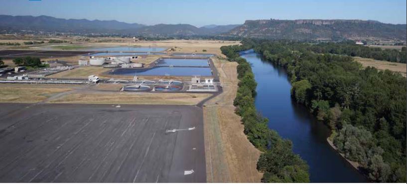
Since 2011, The Freshwater Trust (TFT) has been working with the City of Medford, Oregon, to plant trees along the banks of the Rogue River to mitigate the effects of the warm water that is discharged by the city’s wastewater treatment plant.
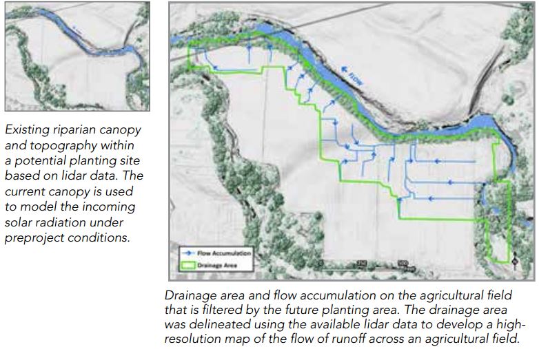 The nonprofit uses ArcGIS® to identify the areas along the Rogue River that are best suited to restoration.
Medford discharges 17 million gallons of clean—but warm—water into the Rogue River daily. Warmer rivers have less oxygen and cause fish eggs to incubate earlier, hindering survival. To comply with the Clean Water Act, TFT offered a natural solution: plant trees to generate the shade needed to cool the water. For this to work, the organization needed to calculate the thermal benefits from increased shade and scout the watershed to identify where the shade could be produced.
“Planting trees would end up saving the city more than $8 million and provide large-scale benefits for the watershed as a whole, including sequestering carbon, filtering pollutants, and providing critical habitat for wildlife,“ said Julia Bond, Science Director at TFT.
Shade generated from the trees is quantified and expressed as credits that the City of Medford purchases to meet its permit obligations.